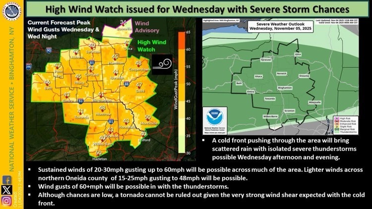
The National Weather Service (NWS) has issued a High Wind Warning for the Hancock area, in effect from 1:00 PM Weds Nov 5th through 1:00 PM Thursday. Residents should be prepared for potentially hazardous weather conditions as a strong cold front moves through the region this afternoon and evening.
According to the NWS, very strong winds and isolated severe thunderstorms are expected. Wind gusts could reach up to 60 miles per hour, with even stronger gusts possible in thunderstorms. The combination of strong wind shear and unstable atmospheric conditions also brings a small but notable risk of an isolated tornado.
Officials are urging residents to take precautions:
- Secure outdoor furniture, decorations, and garbage bins.
- Avoid parking vehicles under trees or near power lines.
- Be prepared for possible power outages and downed trees or branches.
- Use caution when driving, especially on open roads and bridges.
If severe weather develops, residents should seek shelter indoors and stay tuned to local weather alerts or NOAA Weather Radio for updates.
The State Emergency Management team will continue to monitor conditions closely and provide updates as needed.
For the latest information, visit the National Weather Service website or Town of Hancock App for live updates.

Stay safe and be weather-aware, Hancock.